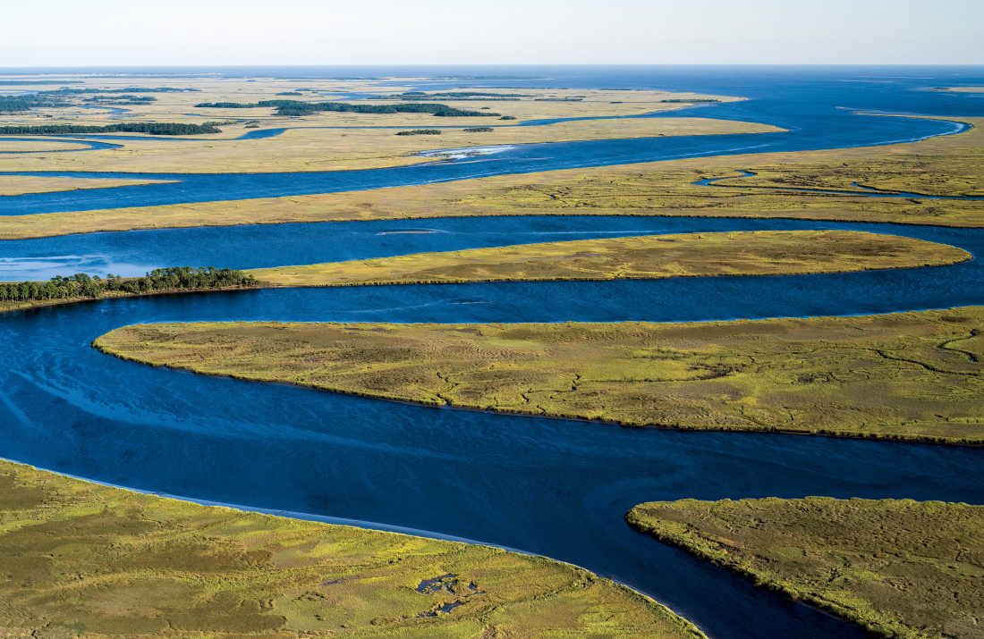
From the ground, it’s all but impossible to really get a sense of the vastness of the Chesapeake Bay and its surrounding watershed, spanning six states and some 64,000 square miles. Which is why Virginia-based photographer Cameron Davidson has spent more than a decade shooting the bay and its intricate network of tributaries from helicopters and small airplanes. The results are gorgeous, almost painterly aerial landscapes that provide a rarely seen perspective of the region’s natural beauty.
But Davidson isn’t just interested in capturing pretty pictures. Looking down from above, the shots also reveal man’s ever-increasing presence—pollution, shoreline development, erosion—and how fragile that beauty is. “It’s the easiest way to show the interaction of man and land and water, and the impact of that,” Davidson says. “When you’re at water level or just on a bridge, you don’t see things at the same kind of scale and connectedness.”
Davidson is currently compiling his images into a soon-to-be-released book, which he hopes will aid in education efforts about the conservation challenges facing the bay. But for now, check out this gallery of his work. “The goal is to educate people that we’re all a part of the Chesapeake Bay watershed,” he says, “from Virginia all the way to New York.”