
No matter which trailhead you choose, it doesn’t take a long hike into Alabama’s Sipsey Wilderness to step back in time a few millennia. The sounds of rushing water are never far away from the primitive footpaths, which usher visitors into a lush landscape where spring-fed creeks have long carved their way over, around, and through imposing boulders and rock walls. And in winter, the rewards of hiking and camping here multiply.

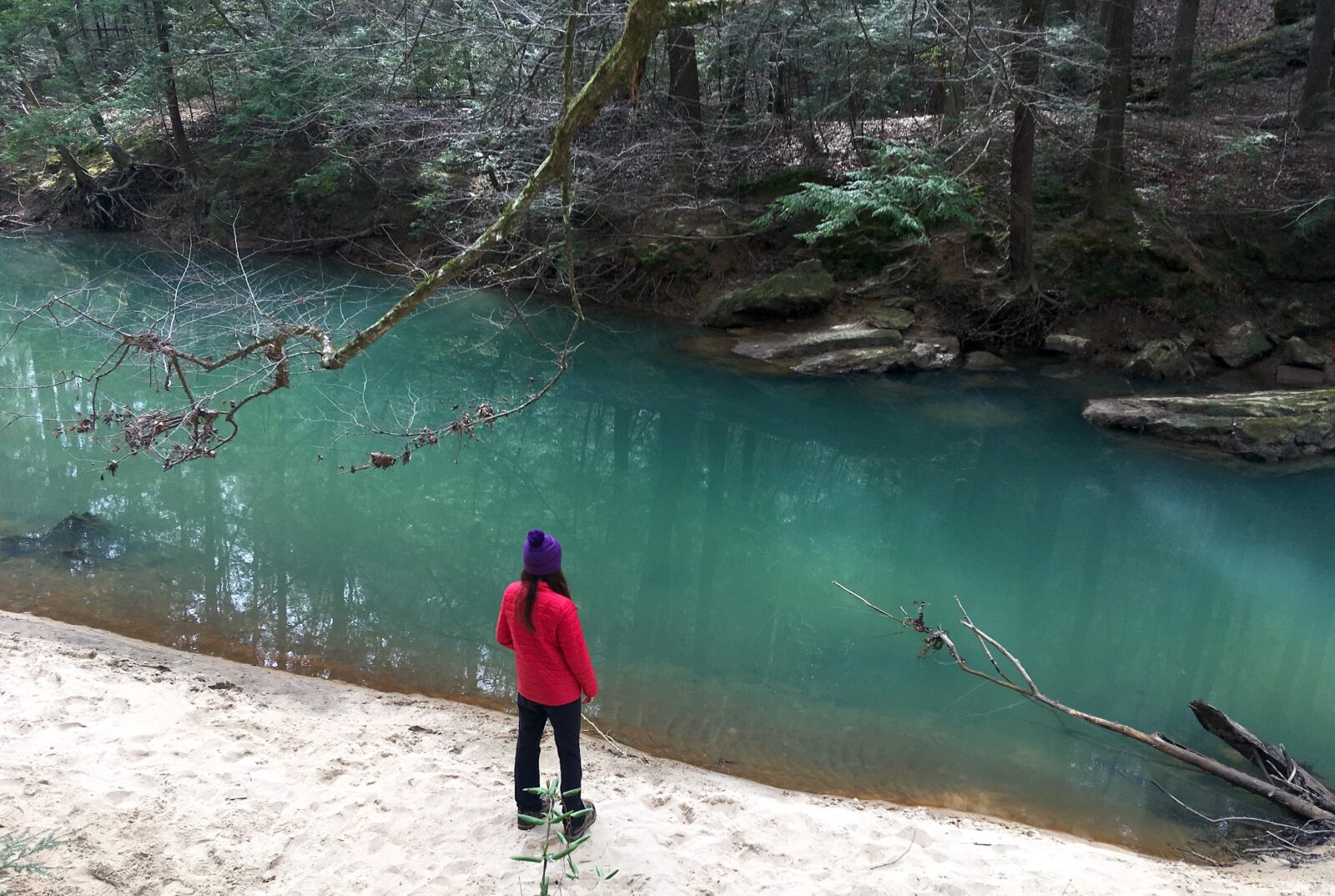
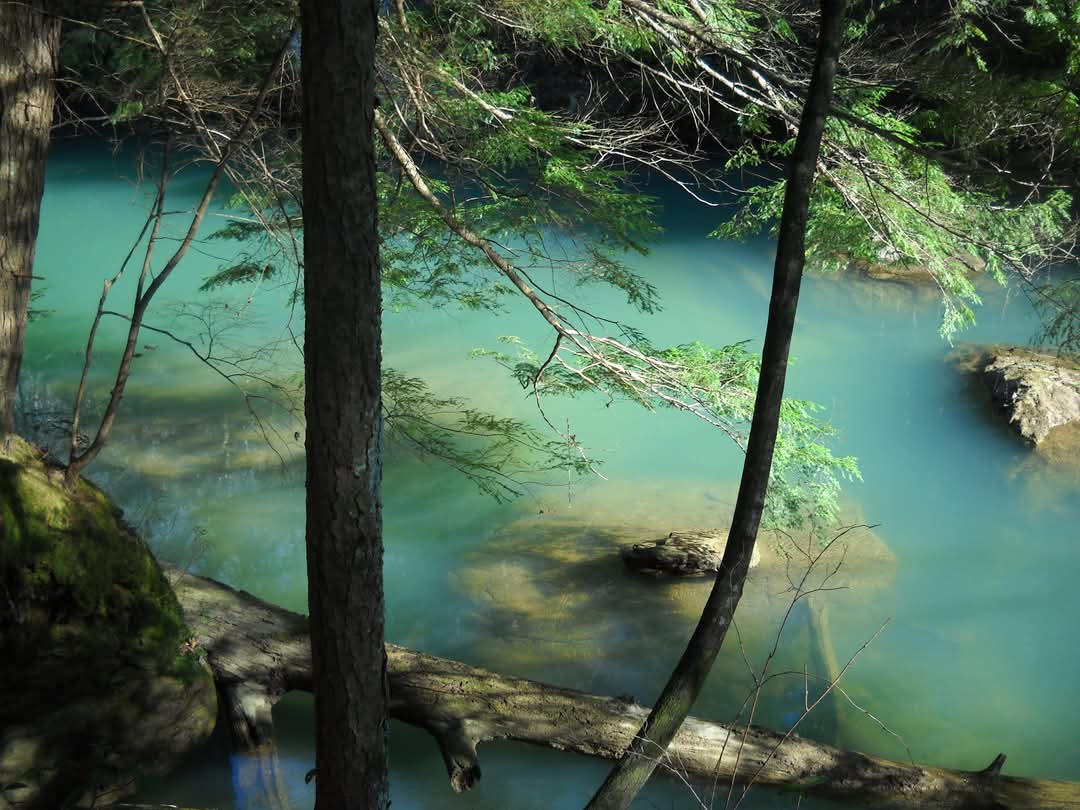
Sixty miles northwest of downtown Birmingham, the southern reaches of the Highland Rim and Cumberland Plateau geological formations culminate at this thirty-eight-square-mile, pack-in/pack-out jewel of Bankhead National Forest—a deep canyon formed by the Sipsey Fork, Alabama’s only designated National Wild and Scenic River, and its network of tributaries that carry a striking turquoise hue during the coldest months of the year.
“You have a really old drainage network that has been evolving over a very old terrain,” says Lisa Davis, an associate professor in the Department of Geography and Environment at the University of Alabama who studies how rivers change landscapes. “You get to see the driving impacts and the movement of water over time.”
The sandstone canyon walls and boulders that litter the landscape and creek bottoms of the Sipsey are estimated to be between 250 and 550 million years old and likely formed during a heightened period of tectonic activity that occurred in the Appalachian orogeny. Distinct geological formations like Ship Rock and the Eye of the Needle—created where parts of the canyon walls have crumbled over the epochs—now provide landmarks and shelter for hikers, climbers, and campers.
“It’s mesmerizing to me,” says Lindsay Madison, a stewardship coordinator for the Bankhead National Forest through the conservation group Wild Alabama, who has visited the wilderness more than a thousand times over the past two decades. “It’s almost addictive being out there, because the little ecosystem is so fragile. You can see how it changes, yet the familiar is always there.”
Hiking and camping in the Sipsey during the cold-weather months offer rewards far beyond the dearth of ticks, poison ivy, and even venomous snakes visitors can find in summertime. Here are three great reasons to put a trip to Sipsey Wilderness on your winter outdoor itinerary.
1. Turquoise Waters
When winter settles on the Sipsey, the spring-fed tributaries turn a brilliant shade of turquoise, most visible in the deeper waters of the Sipsey Fork. As the groundwater filters through layers of limestone, it picks up an emerald tint from dissolved minerals on its way to the surface. “Part of that color transition is because summer is the peak period of biological productivity, when we’re getting way more activity from organisms and their decomposition of leaves and organic matter,” Davis says. In winter, those organic processes all but cease, allowing more minerally derived colors to dominate. Science aside, the sensory effect of discovering accessible streams the color of an alpine lake at a mere thousand feet of elevation is both otherworldly and enchanting.
2. Tree Gazing
“The Eastern hemlocks are a remarkable feature of the Sipsey because they’re left over from the ice age,” Madison says. Seeds deposited by retreating glaciers spawned this isolated stand of hemlocks, the southernmost reach of the conifers. The trees play a key role in the ecosystem of the canyons, providing year-round shade and shelter for ferns, mosses, endangered mussels, salamanders, and turtles. And because they’re evergreen, after the summertime understory dies off, the Wilderness’s signature timber is even easier to spot. (Bonus: If spectacular trees are your thing, you’ll want to pursue the “Big Tree,” a 500-year-old yellow poplar along Bee Branch that stands among the tallest trees in the eastern U.S. at 167 feet.)
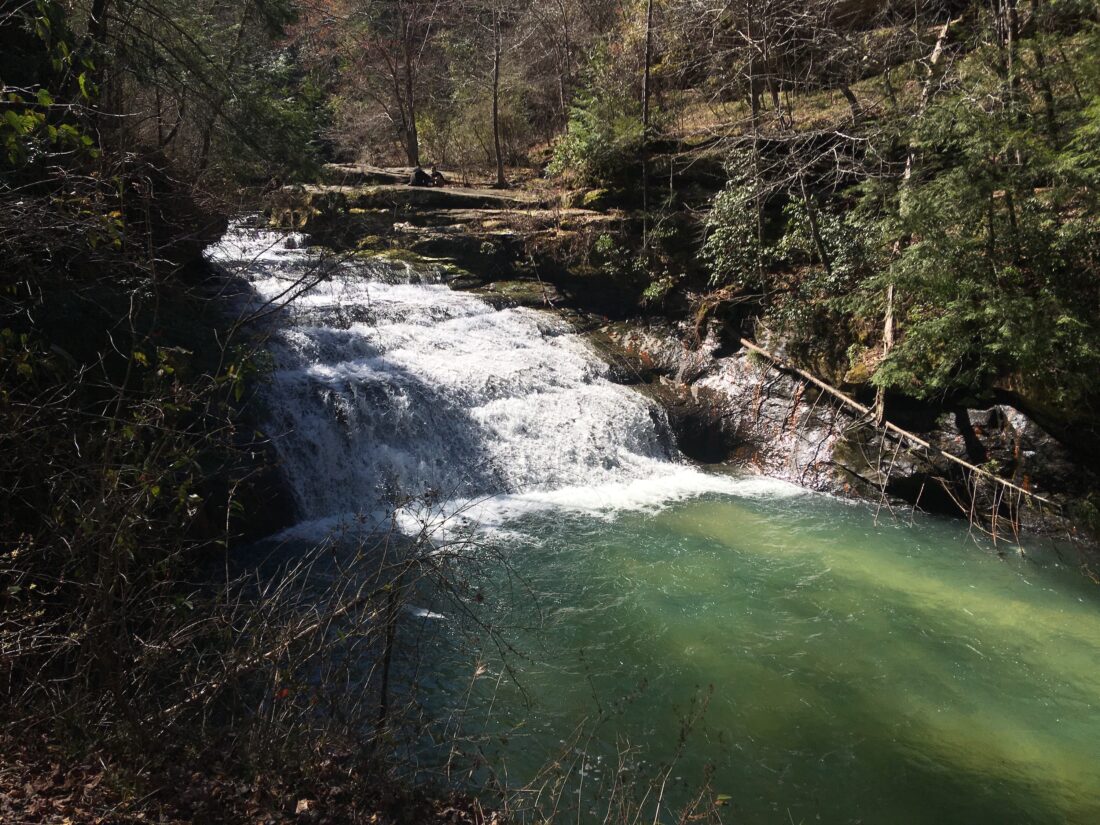
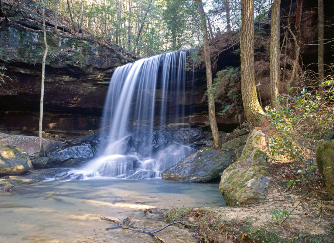
3. Chasing Waterfalls
Bankhead National Forest is nicknamed the “Land of 1,000 Waterfalls” for its abundance of permanent and seasonal waterfalls, and many of them can be found within the Sipsey Wilderness. “That nickname is is not an exaggeration,” Madison says. “For every one waterfall that’s on the map, there’s probably three more that will appear in times of high water.” The falls are usually not hard to find when temps cool off, as four of the area’s five wettest months are in winter. Among the best known are Kinlock Falls, whose water drops down an accordioned series of rocks into Hubbard Creek, while others, like Turkey Foot Falls and Caney Creek Falls, careen dramatically over canyon walls and ledges.
Jim Beaugez writes about music and culture from his native Mississippi. He has contributed to Garden & Gun since 2021 and has also written for the New York Times, Rolling Stone, Smithsonian, Oxford American, and Outside.