
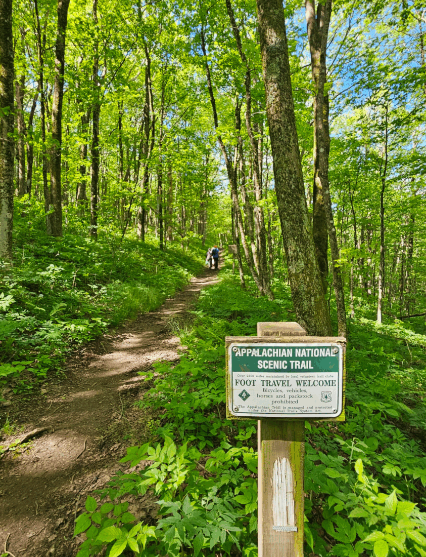
Preserving all 2,197 miles of the Appalachian Trail is a unique labor of love, one undertaken since 1925 by the Appalachian Trail Conservancy, the only nonprofit devoted exclusively to managing, protecting, and advocating for America’s most famous footpath. Even a milestone as major as a centennial can’t keep the ATC’s five thousand volunteers from the deep forests and ridgelines they love.

Luckily you don’t have to be a hardcore thru-hiker to join them. Starting with the AT’s southern end in Georgia and striding steadily northward, we asked those who know the trail best for day-hike picks in all fourteen AT states. Remember to pack snacks!
GEORGIA: Dicks Creek Gap
4 miles round trip for short hike; 11 miles round trip for longer hike
In the South, the AT famously begins on Springer Mountain, but Mike McCollum of the Georgia Appalachian Trail Club elects to head into the state’s northeast corner—and farther away from Atlanta—for his favorite day hike. “Springer is great and Blood Mountain is beautiful, but there might be five hundred people on those trails on a Saturday,” he says. “At Dicks Gap, things are very rural and mountainous. You’re not going to be hiking behind someone wearing flip-flops.” From the trailhead, aim north on the AT for a couple of gentle uphill miles along a creek through mountain laurels and rhododendrons that bloom in late spring. If you’ve had enough, turn around, or trek another few miles, passing a side trail to the Plum Orchard shelter and reversing course at the U.S. Forest Service kiosk at Blue Ridge Gap. “Most of the time you’re in the forest,” McCollum reports, “but there are moments when the trees open up to expansive mountain views.” Sightings of eagles, turkeys, and black bears are common, and McCollum has even crossed paths with wild boars. Once you’ve gone out and back, drive to the nearby trail towns of Hiawasee or Clayton, both of which reward hikers with craft brews and good eats.
Access: Dicks Creek trailhead off US-76 near Hiawasee, Georgia
NORTH CAROLINA: Sam’s Gap to Big Bald
13 miles round trip
This is a long, somewhat strenuous hike that delivers 360-degree panoramic view to hikers who feel up to the challenge, according to Paul Curtin of the Carolina Mountain Club. About a mile in, the incline kicks in, but there’s also a big wildflower meadow that provides a sneak peek of Big Bald in the distance. Next, continue up along a stream and weave through a boulder field about a mile from the summit. “Then you pop out of the woods into an open area, and the view just gets better and better,” Curtin says. “Once you’re on Big Bald, you get panoramic, 360-degree views of all the peaks in the region—Mount Mitchell, the Roan Highlands, and all the way back to the Smokies.” Whew! Stop, rest, and let your eyes get their fill. At least the return trip is downhill!
Access: About 35 miles north of Asheville, park in the area underneath the I-26 overpass at Sam’s Gap.
TENNESSEE: Laurel Fork Falls
5 miles round trip
The AT hugs Tennessee’s wobbly border with North Carolina for 220 miles before it finally makes a 74-mile dash across the state’s pointy northeastern tip to reach Virginia. Even so, this day hike ranks among the best, especially if your soul yearns for a remote swimming hole. From the trailhead, walk a mile past Buckled Rock Cliff to hit the AT and turn south. Hike upstream, using footbridges to cross pretty, shaded Laurel Fork, and ascend a ridge for views of the gorge. At the junction to Laurel Fork Shelter, stay on the main trail and descend along a cliff base to Laurel Falls, which cascades into a broad, shallow swimming hole.
Access: The U.S. Forest Service maintains a trailhead parking lot on US-321, about 1.5 miles east of Hampton, Tennessee.
VIRGINIA: Angel’s Rest
5 miles round trip
“This hike is a little steep in some places, but you’re distracted from the effort by how pretty it is,” says Erin Gifford, creator of a website guide (gohikevirginia.com) to more than three hundred hikes she’s taken in the state. Follow a series of switchbacks up Pears Mountain in the spring and you’ll likely encounter a riot of purple phlox and a few AT thru-hikers on their way down to the nearby trail town of Pearisburg. “You can spot them by the state patches they’ve collected along the way,” Gifford says. “I love to talk to them and ask about their hikes so far.” After some alternating uphill and flat stretches and a maze of big rocks, mile marker 1.8 points to Angel’s Rest lookout. “From there, it’s a very short walk to a perfect boulder that angels—or hikers—can sit on to watch over the New River and Pearisburg,” Gifford says. Don’t turn around yet. Continuing on the AT to the 2.5-mile mark brings you to a second lookout, marked by a lone tree, with a commanding view of Wilburn Valley’s woods and farms. “So pretty,” Gifford says. “You definitely burn some calories getting there, so I recommend heading back into town to the little Mexican restaurant. It’s really good.”
Access: From Pearisburg, take Cross Avenue west of town about a mile. There is room for cars to park beside the road just past the marked trailhead.
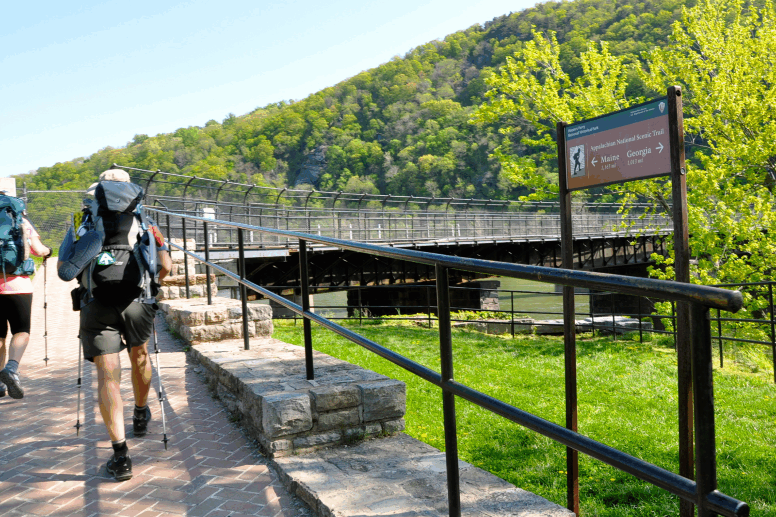
WEST VIRGINIA: ATC Harpers Ferry Visitor Center to Split Rock
7.6 miles round trip
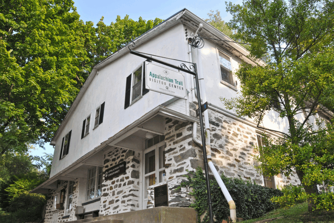
Known as the “psychological midpoint” of the AT, the Appalachian Trail Conservancy headquarters in Harpers Ferry also serves as the starting point for a solid day hike. “If you’re into pawpaws, keep an eye out,” says ATC visitors center representative Dave Tarasevich, “because you walk past several productive patches.” After an initial brief uphill, the top of a switchback connects to the Loudon Heights Trail and follows along the side of a ridge that defines the border between West Virginia and Virginia. From there, you lose some elevation through a wooded stretch on the way to Split Rock. “The overlook is a rock that juts out a couple of hundred feet up and a little downstream of the confluence of the Shenandoah and Potomac Rivers, so it’s a pretty good view,” says Tarasevich.
Access: From the ATC visitors center, walk two blocks and cross the bridge over the Shenandoah River, then follow the access trail uphill.
MARYLAND: Annapolis Rock to Black Rock Cliff
7 miles round trip
Though Maryland is one of the flattest states on the entire AT, this hike delivers two spectacular lookout points. “It’s listed as moderate, but it’s actually a fairly easy hike,” says Melanie Spencer of the Appalachian Trail Conservancy. “Like most of the trail in Maryland, you can do it any time of year, even winter.” From the trailhead, turn left onto the white-blazed AT and soon you’ll pass two connectors to Pine Knob Shelter before taking the short connector for a gradual ascent to Annapolis Rock. Back on the AT, continue to mile marker 3.7 and take the side trail to Black Rock Cliff. Catching your breath on the bare outcropping, you gain a 180-degree view of a scree field down below and hills rolling away into the distance. “It’s really beautiful up there, and probably the highest viewpoint in Maryland,” Spencer says.
Access: I-70 exit 42 onto MD-17N for .9 miles, right onto MD-17 S for .5 miles, left onto US-40 for 3 miles to parking lot
PENNSYLVANIA: Weathering Knob
2 miles round trip
There’s some steep going here, but the reward is sweet and the overall length of the trail is relatively short. Following the AT north, pass through an often-boggy patch before an ascent over rocks and boulders made easier by stone steps built by volunteers. (Thanks, volunteers!) The sweeping northerly view from Weathering Knob looks over a valley framed by Chestnut Ridge and Stony Ridge. From there, the trail stays fairly level along the crest of Blue Mountain until you reach a second knob at the 1-mile mark. Soak in southerly views of small settlements and patchwork fields before the trip back down.
Access: From Danielsville, Pennsylvania, follow Blue Mountain Road north to the Pennsylvania Game Commission parking lot. A side trail from the back of the lot leads to the AT.
NEW JERSEY: Sunrise Mountain and Culver Fire Tower
7.2 miles round trip
Forest fire lookout towers tend to be purpose-built at remote spots with commanding views, which also makes them prime hike destinations. This trek begins at the Sunrise Mountain Pavilion, a handsome stone structure constructed by the Civilian Conservation Corps in the 1930s, and flows south on the AT along a rocky ridgeline that delivers views to the northwest before crossing through woods and past several local connector trails on its way to Culvers Lookout. Erected in 1933, the steel tower’s six flights of stairs reach a still-manned cab forty-seven feet up. Climb on up to say hello and take in a 360-degree vista of surrounding hills and Kittatinny Lake to the southwest.
Access: From Culver Gap, New Jersey, follow Upper North Shore Road for .25 miles, then turn onto Sunrise Mountain Road and follow it to the parking lot.
NEW YORK: Denning Hill
5.2 miles round trip
Just 50 miles from New York City, this hike delivers decompression via immersive nature. Shortly after picking up the AT heading north into deep woods, you traverse several split-log bog bridges and continue through trees, a briefly steep stretch, and a grassy patch before crossing Old West Point Road. Enter woods again, ascend Little Fort Hill and pass a side trail that leads to Graymoor Monastery. (The monks fed and sheltered long hikers until the 1990s.) At mile marker 2.6, after another short, steep climb, follow the ridge of Denning Hill to a sweeping view of Westchester County, the Hudson River, and on a clear day, even the distant Manhattan skyline.
Access: Starting from Peekskill, New York, drive US-9 north a bit more than 4 miles to where the AT crosses the road at the junction with NY-403. Parking is on a side road.
CONNECTICUT: Great Falls
1.4 miles round trip
Want a big payoff without breaking much of a sweat? This swift little hike is for you. To lengthen the trek just a bit, you can even follow the white hash marks on the street that show where the AT passes right through Falls Village, a charming, lost-in-time community within the slightly larger town of Canaan. By the time you pick up the hard-packed trail and cross a bridge over the Housatonic River, you’ll likely already hear the falls, especially when spring rains and snow melt greatly boost their volume. And then you’re there! Whip out your phone to capture the state’s second largest falls, a wide expanse that tumbles sixty feet over broad, terraced ledges. Just because it took a short time to get there doesn’t mean you can’t linger for a good long time.
Access: If you prefer not to follow the helpful hash mark from town, parking is provided in a lot just outside the village on Water Street.
MASSACHUSETTS: The Cobbles
2.8 miles round trip
Following white blazes on telephone poles from within the charming Berkshires town of Cheshire, cross the railroad tracks and a bridge over the Hoosic River into a residential area before ascending through a hushed hardwood forest and logging trails. Pass under a rock cliff and take the blue-blazed side trail through a grove of mountain laurels to reach a rocky cluster of exposed viewpoints known as “the Cobbles.” To the west you can see the town, the river, Mount Greylock, and mountains rising in the distance. (Also keep an eye out for moose!) Find the bronze USGS survey marker set into a rock and turn back, or to lengthen the hike, continue on the AT for a bit.
Access: The AT passes through the town of Cheshire. Parking is available at the Ashuwillticook Rail Trail lot across from the post office on Church Street.
VERMONT: West Hartford to Thistle Hill Shelter
9.6 miles round trip
“I think this is one of the most underrated parts of the whole AT,” says Vermont-based ATC information services manager Caitlin Miller. “It’s quintessential Vermont, lots of pastures and open fields with native flowering plants, butterflies, and bees. There’s milkweed in late summer that attracts monarchs.” Starting from West Hartford, the trail winds over rolling hills and through reclaimed farmland now maintained by the ATC, U.S. Forest Service, and Green Mountain Club to provide habitat for birds and pollinators. Turn around at the log-built Thistle Hill Shelter (and its unique, gazebo-like privy) for an out-and-back hike of about 10 miles, or stage a vehicle a bit farther up the trail at Cloudland Road to shave off a couple of miles. “The whole hike is gorgeous,” Miller says. “Every time I go there for a trail maintenance day, I feel lucky.”
Access: Pick up the AT on VT-14 in West Hartford, Vermont. Parking is available at the rear of the public library lot; check in with the desk on weekdays.
NEW HAMPSHIRE: New Hampshire 25A to Mount Cube
7 miles round trip
Several scenic stretches in New Hampshire’s White Mountains, such as Franconia Ridge, are justifiably famous. “But there are less busy day hikes than that main area of the Whites,” says ATC information services manager Caitlin Miller, “and Mount Cube is one of the best, with a big reward at the top.” Heading south on the AT through a forest of hardwoods and spruce, the path uses a rock hop to easily ford Brackett Brook (unless it’s swollen after a heavy rain), then ascends to Mount Cube’s rocky outcropping. “The cool thing is that there are two summits, the south summit on the main trail and a north summit via a short spur trail,” Miller says. “You get two different stunning panoramic views from rocky outcrops.” Note that “mud season”—roughly mid-March through May—is not the best time to tackle this trek.
Access: Parking for about ten cars is available in a large dirt pull-off at the AT crossing on NH-25A near Piermont, New Hampshire.
MAINE: Piazza Rock
3.6 miles round trip
The Maine AT section known as the Hundred-Mile Wilderness is notoriously treacherous—so we’re staying well to the south of that for this interesting day hike. The trek kicks off with a short push uphill before leveling out through dense woodlands and across bog bridges before reaching the “rock star” attraction. Piazza Rock is an enormous, flat slab of granite that slid out of the side of Saddleback Mountain but somehow cantilevered in the air instead of breaking off. Scramble atop for a photo opportunity, or if you’re feeling especially invincible, pose underneath the broad, multi-ton overhang.
Access: Trailhead parking is along State Route 4, 9 miles south of Rangeley.
Steve Russell is a Garden & Gun contributing editor who also has written for Men’s Journal, Life, Rolling Stone, and Playboy. Born in Mississippi and raised in Tennessee, he resided in New Orleans and New York City before settling down in Charlottesville, Virginia, because it’s far enough south that biscuits are an expected component of a good breakfast.