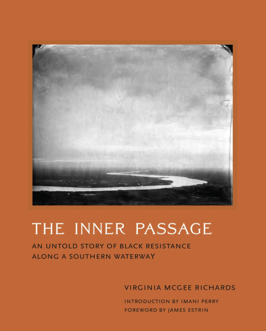
Arts & Culture
A Charleston Historian Used an Antique Photography Method to Blur Past and Present, with Stunning Results
“The Inner Passage,” Virginia McGee Richards’s new book and photo project, shines an otherworldly light on a canal system dug by enslaved hands
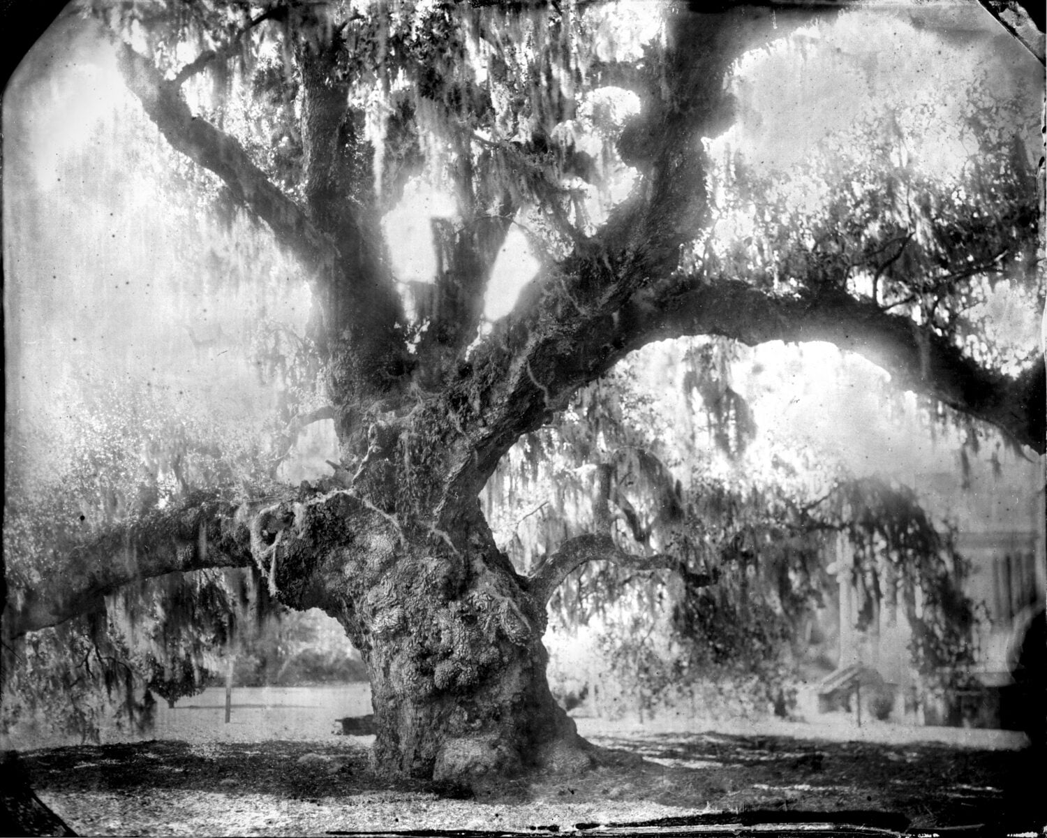
Photo: Virginia McGee Richards
McLeod Oak, James Island records a ”witness tree“—estimated to to be between 300 and 600 years old—on Charleston’s McLeod Plantation.
A South Carolina historian’s fifteen-year photo documentary project—one involving long days combing library archives and recording interviews and countless hot, humid hours developing wet plates and constructing a dark room outdoors—began with a swim in the river.
On a warm summer day, Virginia Richards moved through the dark waters of New Cut Creek, a tributary of the Ashepoo River in Colleton County, South Carolina. Surrounded by the tall spartina grass and dark muddy banks on Wadmalaw Island, just south of her Charleston home, she began to ask herself where the name New Cut came from.
For Richards, who grew up exploring the North Carolina woods with her brother (“open-water swimming, digging in creeks and in the woods, and digging holes and looking for things like pottery, glass, and arrowheads”), asking questions about the world around her came naturally. After a career as an environmental lawyer for organizations like the Southern Environmental Law Center and the Conservation Law Foundation, she turned to what she knew best—documents and records—to begin tracing the history of this three-hundred-mile waterway network in the Lowcountry.
But when Richards headed to the main Charleston County Public Library on Calhoun Street, nothing for New Cut Creek turned up in books. Nic Butler, a local researcher and historian, pointed her to flat microfiche sheets and maps. “Initially my interest was learning about where we were swimming,” Richards says. What she thought had been a natural finger of a larger river turned out to be a canal dug by human hands. “As I began, I learned New Cut had been excavated by enslaved men from ages sixteen to sixty.”
Richards discovered New Cut Creek wasn’t the only passage excavated by enslaved people. By 1720 twelve other cuts, dug in the pluff mud by men with kayendo paddles, formed a transportation network around the Charleston area to deliver plantations’ “Carolina gold” rice, tobacco, cotton, and indigo by boat. In 1712 a South Carolina colonial legislature passed an act to make and repair “highways,” including orders to connect Wappoo Creek and the Stono River. Commissioners forced enslaved workers to make the transport routes.
Richards’s research led her down a path of documents—plat maps, GIS land survey maps, and property ledgers. “I discovered all kinds of things: There was a group of freed men who self-emancipated from Charleston and had a settlement at the end of New Cut near the late 1700s, living as free people in this outpost; Indigenous people had been traveling up and down the coast on the Inner Passage, using canoes; Clara Barton came through New Cut for the Red Cross to survey damage on the islands and help people,” she says. “I learned the scope of the whole operation of the Inner Passage.” But as she pored over maps and looked for the names of the enslaved laborers who excavated the canals like New Cut, nothing came up; the white planters and farmers names were the only ones recorded.
As sea level changes and natural tidal erosion returned some hand-dug canals back to marshland, Richards sought to document “what was there and visually disappearing.” Her digital camera could capture the land as it looked, but not so much how it felt. That’s when she saw a book by her friend, photographer Tomas van Houtryve, and asked him to teach her his wet plate process.
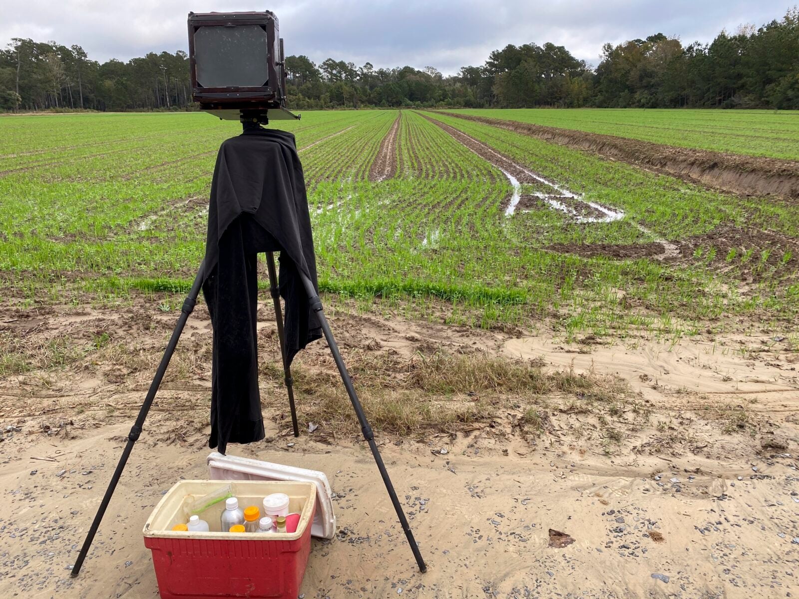
Photo: Virginia McGee Richards
Richards’s photography set up in the field at Bugby Plantation on Wadmalaw Island.
Photo: Virginia McGee Richards
Richards’s resulting plate, Ancient Field, Budby Plantation, Wadmalaw Island.
This analog photography process is imperfect and emotive, influenced by temperature, humidity, and light. It demands patience and labor—pouring collodion and then silver nitrate onto tin plates, slotting a photo-sensitive plate into a camera, and exposing it for a few seconds to produce the image. Richards often woke up at four in the morning to walk the land by foot, set up a dark-room tent for developing and washing the plates, and readying the camera for early-morning light before the South Carolina heat beat down on her. “The process is a bit capricious,” Richards says. “I had to be willing to embrace that the process has a mind of its own.”
Richards’s The Inner Passage: An Untold Story of Black Resistance Along a Southern Waterway, published this spring, shares her research findings alongside sixty hypnotizing images in cloud-colored whites and deep, inky blacks. Take a closer look at some of her photos below.
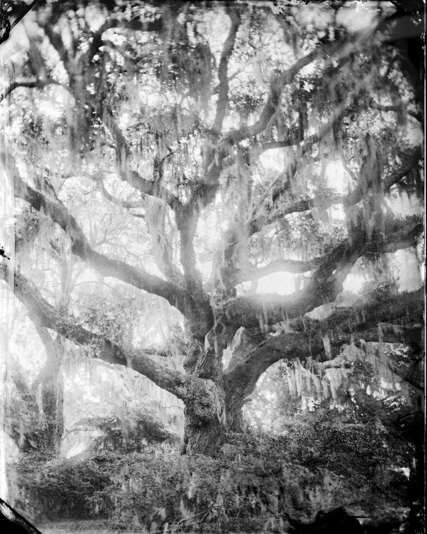
Photo: Virginia McGee Richards
Witness Tree, Wadmalaw Island.
Richards called this image of a tree near New Cut Creek a “Hail Mary” photo. “I had driven up to this tree after shooting all day,” she says. With the sun fading, she pushed herself to capture the last of the light coming through the winding structure of the tree. A forty-second exposure and complete stillness rendered hot, humid air floating through the twisting branches of the oak. These portraits of “witness trees” honor the trees as “the only living things that had seen the whole excavation and life of the Inner Passage waterway,” Richards says.
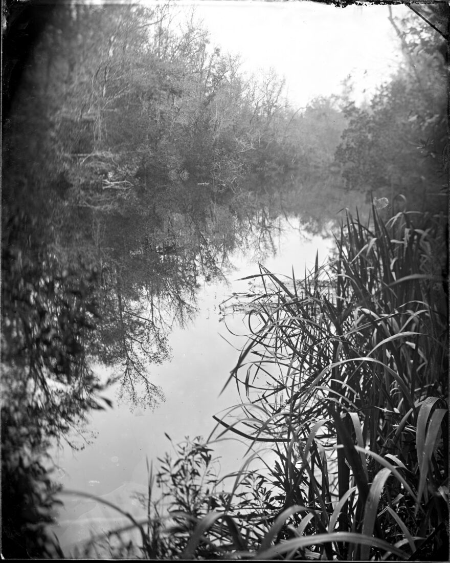
Photo: Virginia McGee Richards
Johno Creek, Colleton County.
On the banks of the Johno Creek in Colleton County, the water’s surface reflects the blue light of the sky, which in the wet-plate process reads as white. “It was a really still day,” Richards remembers. Farms used this waterway to carry and deliver rice more than forty miles on the Inner Passage to Charleston.
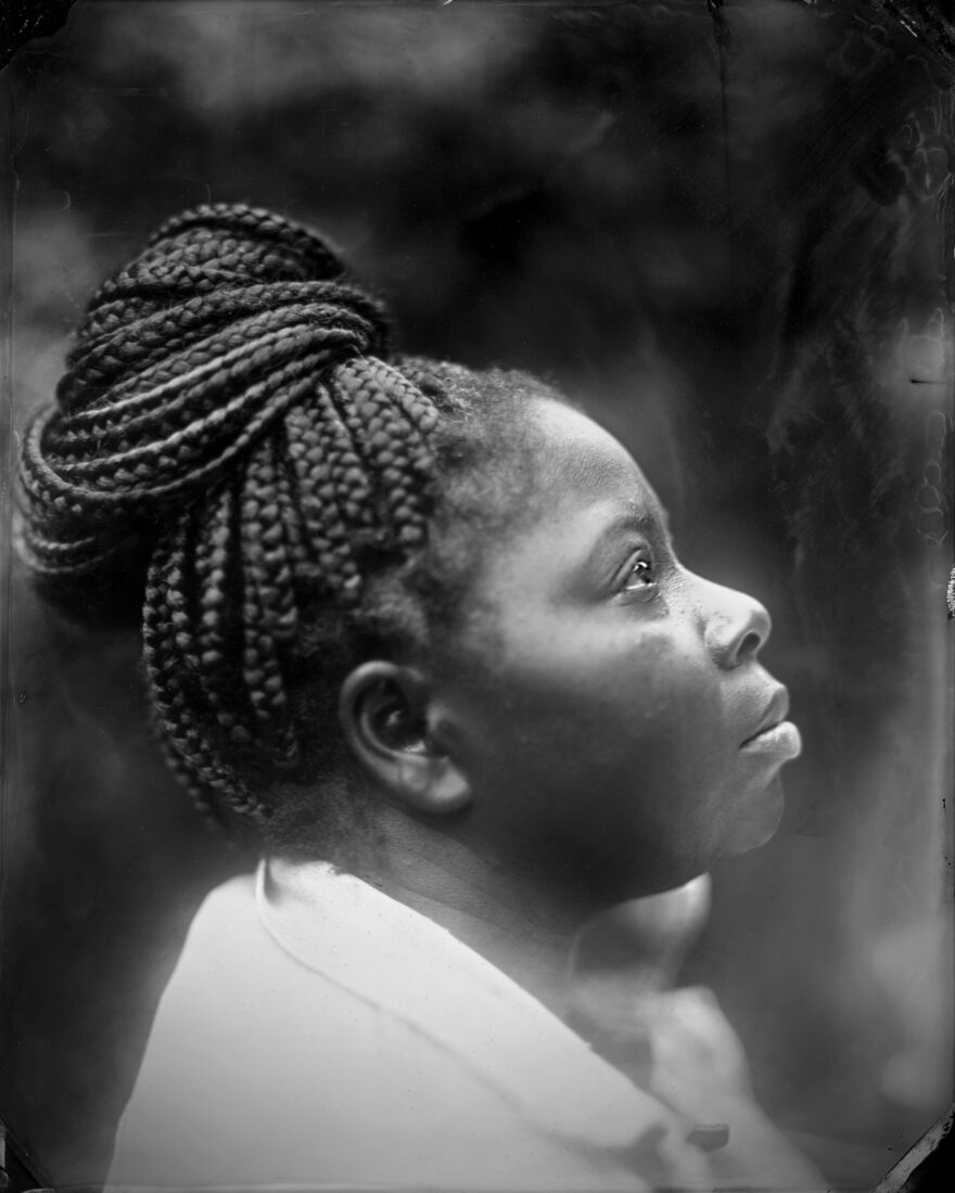
Photo: Virginia McGee Richards
Nicole Moore, Native of Charleston.
“I worked on the project for so long near the water, I began to meet and talk to people who wanted to see what I was doing,” Richards says. As she photographed the landscape, she also began to learn more about the people who traced their lineage as far back as the trees. “People’s interaction with the land over time was so important and integral to the project,” she says. Richards met Nicole Moore (pictured here), a Charleston native living in Atlanta, when they both worked on the National Parks Commission. Moore’s ancestor, Mary Mathews Just, a teacher and community activist, founded an African American community after the Civil War and inspired the name for Maryville, a town formed in 1886 by a group of Gullah Geechee people and freedmen.
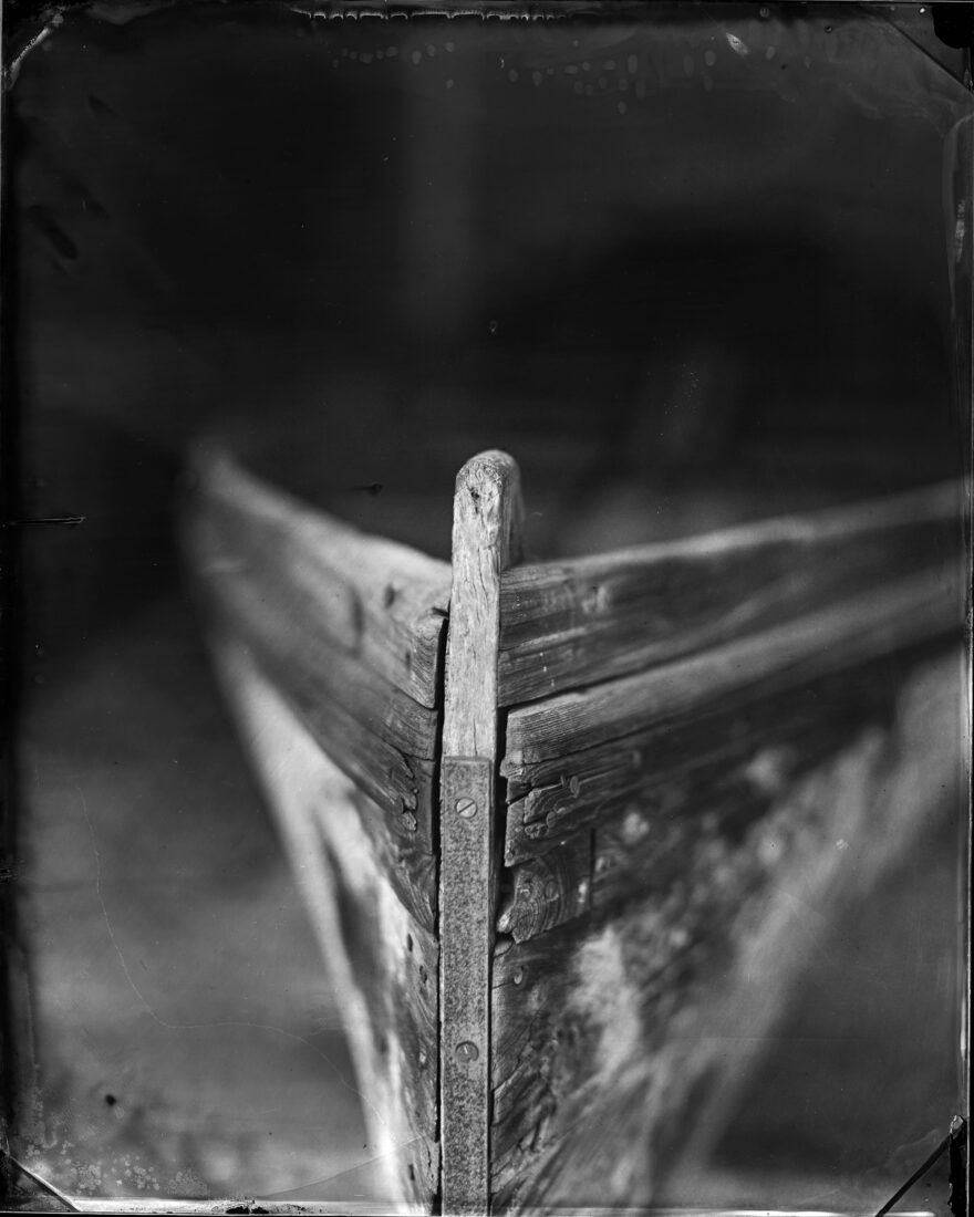
Photo: Virginia McGee Richards
Plantation Boat, Circa 1840s.
This image of a plantation boat from the 1840s was shot at the Charleston Museum. “Bessie, a plantation barge with a hull from a single cypress log, was built in the 1800s on a rice plantation and used for travel on the Inner Passage waterway,” Richards explains in her book.
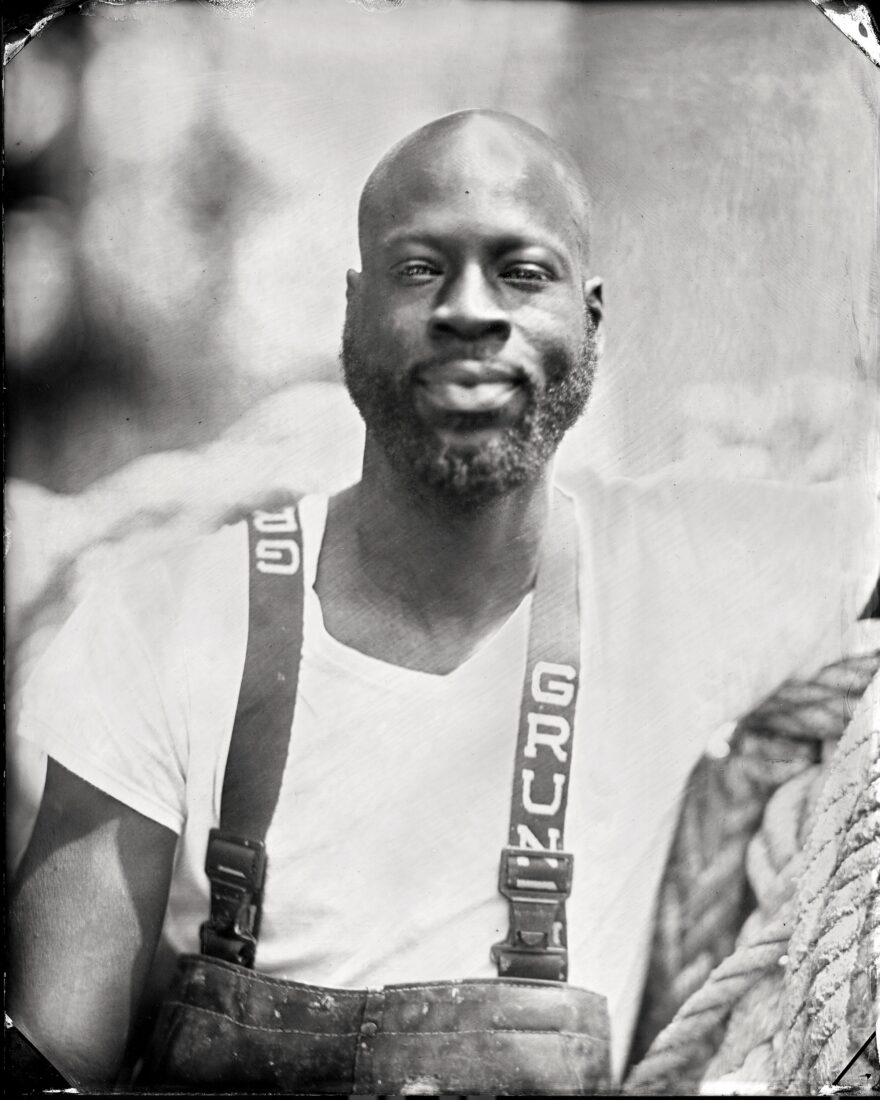
Photo: Virginia McGee Richards
Sherman Mack, Wadmalaw Island.
Sherman Mack, a waterman and artist, was raised on Wadmalaw Island, just as both sides of his grandparents were. In his portrait, weathered rope and well-worn waders nod to his family’s legacy of fishing. Mack’s cool confidence shines against the misty, atmospheric background of Wadmalaw.
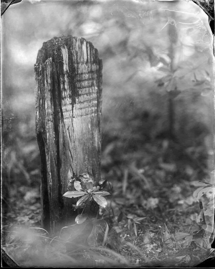
Photo: Virginia McGee Richards
Wooden Marker, Cooper River.
Richards came upon this notched heart-cypress marker in an unmarked graveyard by a quiet bluff overlooking the Cooper River. She ran half a mile back to her car, grabbed her supplies, and laid out all the trays to document the grave.
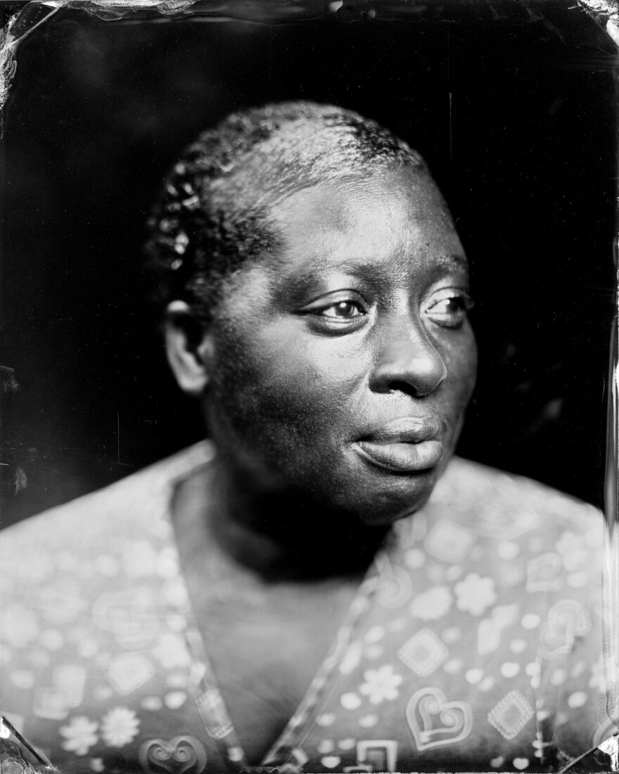
Photo: Virginia McGee Richards
Kathy Fludd Homes, James Island.
Kathy Fludd Holmes can trace her ancestry back to Molly Fludd, who was born in 1830 on James Island. Richards took her photo on James Island, near Holmes’s homeplace that has belonged to her family for generations. “Every year the Fludd family hosts a reunion that draws over two hundred descendants of Molly Fludd back to James Island,” Richards writes.
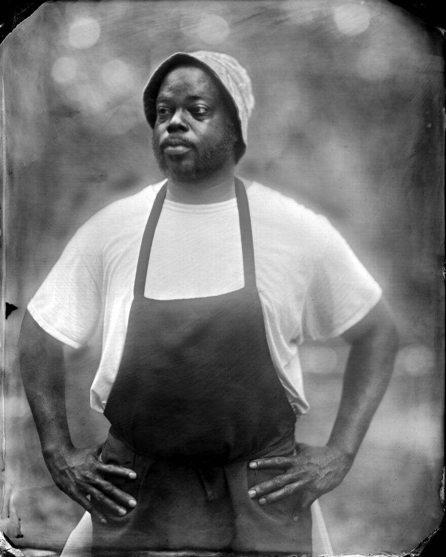
Photo: Virginia McGee Richards
Benjamin Dennis, Ridgeland, South Carolina.
Benjamin Dennis, a Gullah Geechee chef from Charleston, poses in his chef’s apron. “I connect with the ancestors, whose voices speak to me all the time, by cooking food that has been lost,” he told Richards in her book. “When I cook, I am interested in reaching the place where Senegal meets Gullah.”
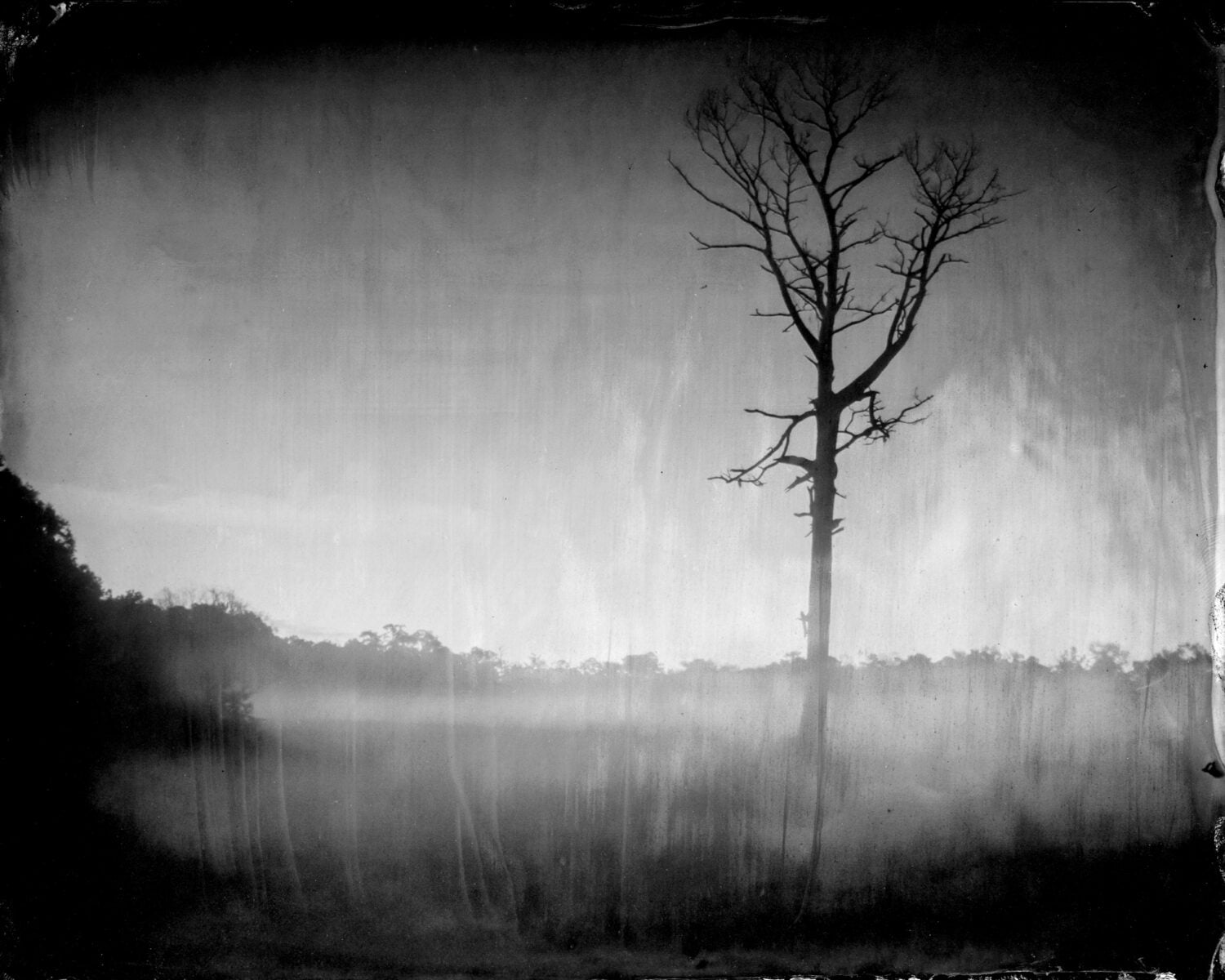
Photo: Virginia McGee Richards
Twilight at New Cut.
The impressionistic strokes in this plate, Twilight at New Cut, are the result of mingling mist and blue light in the landscape. “Watermen could read the tides and navigate by the stars,” Richards says. In the account of Reverend L. R. Ferebee, a formerly enslaved waterman, Ferebee says, “Even at night, I could steer by the compass, or by any star.”
Gabriela Gomez-Misserian, Garden & Gun’s digital producer, joined the magazine in 2021 after studying English and studio art in Virginia’s Shenandoah Valley. She is an oil painter and gardener, often uniting her interests to write about creatives—whether artists, naturalists, designers, or curators—across the South. Gabriela paints and lives in downtown Charleston with her golden retriever rescue, Clementine.
Garden & Gun has an affiliate partnership with Bookshop.org and may receive a portion of sales when a reader clicks to buy a book. All books are independently selected by the G&G editorial team.
Related Stories:
Conservation
Like Indiana Jones with a camera, the photographer and adventurer Stephen Alvarez descends into otherworldly caves to discover, illuminate, and preserve millennia-old drawings

G&G Weddings
Luxe blindfolds, Georgia sports icons, and one very good guide dog made for a one-of-a-kind celebration
Arts & Culture
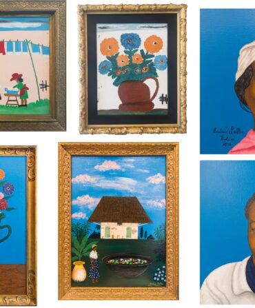
A dazzling new exhibition in New Orleans pairs the work of Clementine Hunter and Andrew LaMar Hopkins
Trending Stories:
Home & Garden
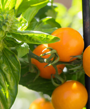
Let ’mater master Frank Hyman narrow the field to a delicious quartet
Music
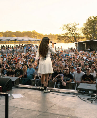
From the Appalachian peaks and valleys where country found its wings, to the Deep South’s holy land of blues, these destinations for live tunes don’t just attract fans, they draw in legends
Travel
Enjoy Florida mangoes, Creole tomatoes, fried chicken, and more with a side of bluegrass