
HURRICANE IAN
How Ian Changed the Coastline of Southwest Florida
Satellite images show the effect Hurricane Ian had on both man-made and natural entities along the coast
These before-and-after satellite images of the Fort Myers area, provided by the National Oceanic and Atmospheric Administration, show not only structural damage but the changing of the shoreline as a result of Hurricane Ian. Some areas sustained significant erosion of sand and dunes, while other areas were overrun with sand and debris.
The before images were taken in 2018, the after images on September 29, 2022, the day following Ian’s landfall in the area.

Photo: NOAA
These before-and-after images of Fort Myers Beach show the destruction of the town’s fishing pier, the leveling of trees and buildings in the commercial district, and a blanket of sand across roads and parking lots.
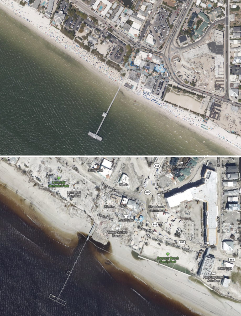
Photo: NOAA
These before-and-after images of Fort Myers Beach show the destruction of the town’s fishing pier, the leveling of trees and buildings in the commercial district, and a blanket of sand across roads and parking lots.
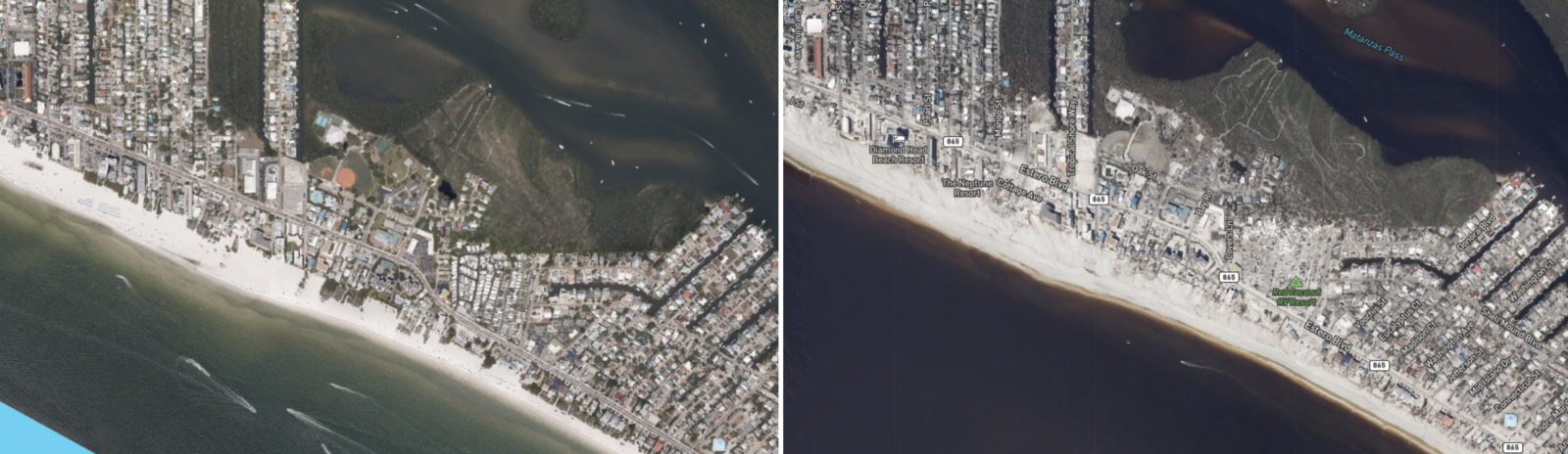
Photo: NOAA
These photos of Fort Myers Beach, approximately from Carolina Avenue to Connecticut Street, reveal how the storm destroyed buildings, stripped trees bare, and pushed sand into streets.
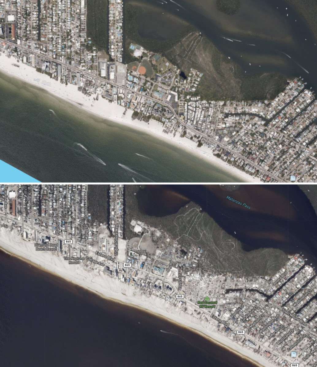
Photo: NOAA
These photos of Fort Myers Beach, approximately from Carolina Avenue to Connecticut Street, reveal how the storm destroyed buildings, stripped trees bare, and pushed sand into streets.

Photo: NOAA
Sanibel Causeway was left impassable by the storm, in part from this breach near Sanibel Island.

Photo: NOAA
Sanibel Causeway was left impassable by the storm, in part from this breach near Sanibel Island.

Photo: NOAA
Sanibel Lighthouse, shown at the bottom right of each photo, is located on the southern tip of Sanibel. The historic lighthouse survived the storm, but the structures and area around it—Lightbouse Beach Park—were decimated.
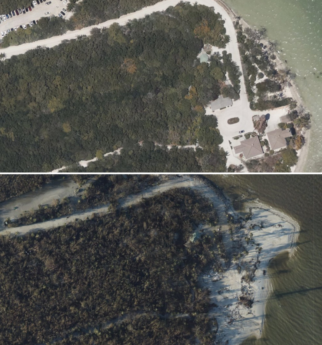
Photo: NOAA
Sanibel Lighthouse, shown at the bottom right of each photo, is located on the southern tip of Sanibel. The historic lighthouse survived the storm, but the structures and area around it—Lightbouse Beach Park—were decimated.

Photo: NOAA
These images show an area of beach homes and condos in Sanibel, along West Gulf Drive between Tarpon Bay Road and Southwinds Drive. In the after photo, note the inlets in the sand created by the storm surge retreating back to the Gulf of Mexico.
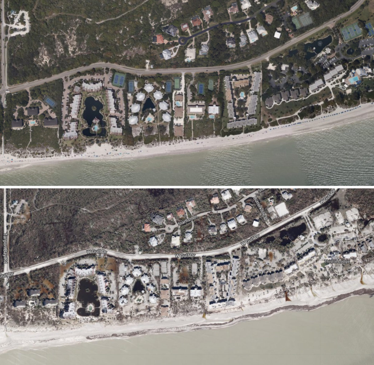
Photo: NOAA
These images show an area of beach homes and condos in Sanibel, along West Gulf Drive between Tarpon Bay Road and Southwinds Drive. In the after photo, note the inlets in the sand created by the storm surge retreating back to the Gulf of Mexico.
Explore for yourself: See more NOAA images of Ian here.
How to help: See our list of organizations involved in the relief efforts.