
You can’t exactly paint lanes on the water, so instead, boaters rely on what can be a sometimes confusing array of markers, floating buoys, flashing lights, and other signage to navigate safely and keep from running aground. As summer moves into full swing and boating season peaks, here’s what you need to know to stay in the deep water and maneuver through marked channels along the coast and in rivers and lakes.

The Maritime Buoyage System, as it’s called, was developed and implemented by the International Association of Lighthouse Authorities (IALA). First, let’s run through a quick glossary, then we’ll dial in on the most pertinent rules and guidelines along with a few pro tips for those times when the rules and guidelines are really no help at all.
What You’re Looking At
Daybeacon
This is a fixed, unlighted marker, typically on a post or posts.
Light
A fixed, lit beacon, typically on a post or posts.
Buoy
Buoys are markers, or “marks” in nautical lingo, that are anchored to the water bottom. They can be green, red, white, yellow, and a combination of those colors. They can be numbered or not numbered, and may bear symbols that relate to dangers or regulations.
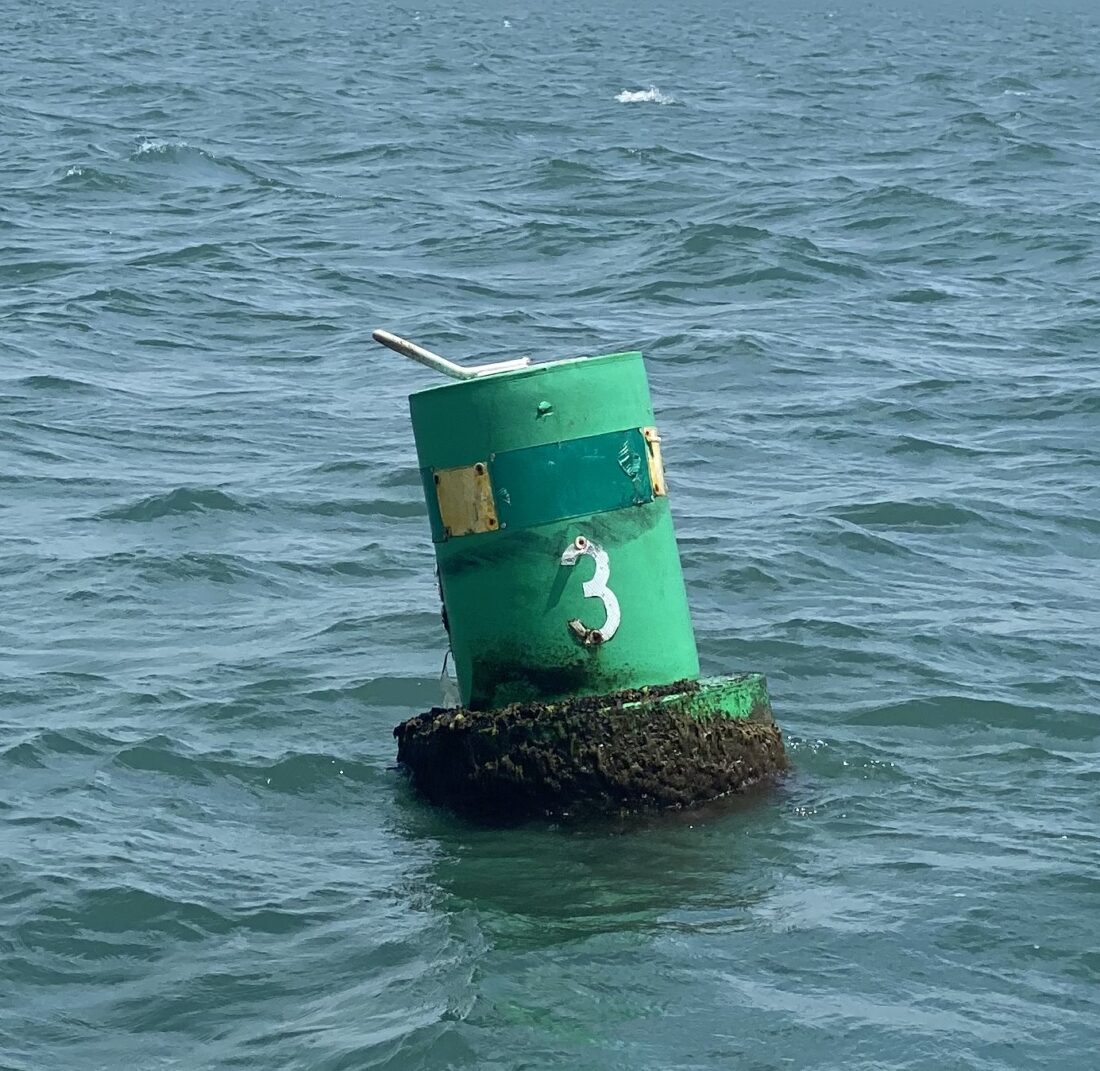
Can
A can is a cylindrical buoy used to mark channels. They will be green, and you pass them with the can on your port hand.
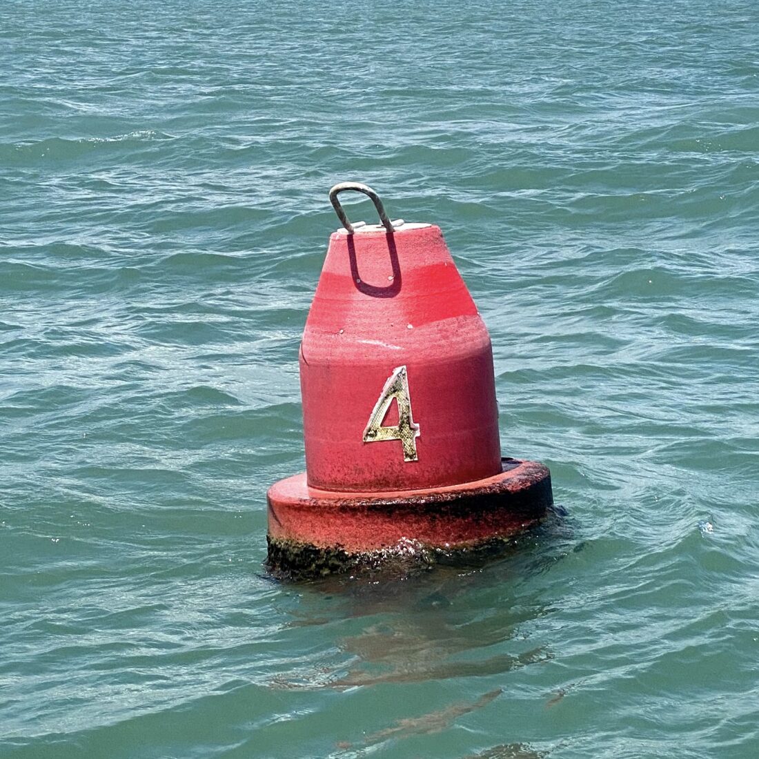
Nun
A nun is a conical buoy, also used to mark channels. They will be red, and you pass them with the nun on your starboard hand.
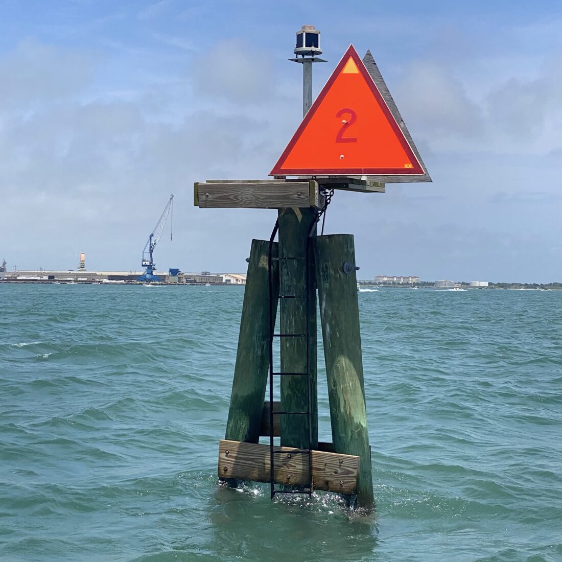
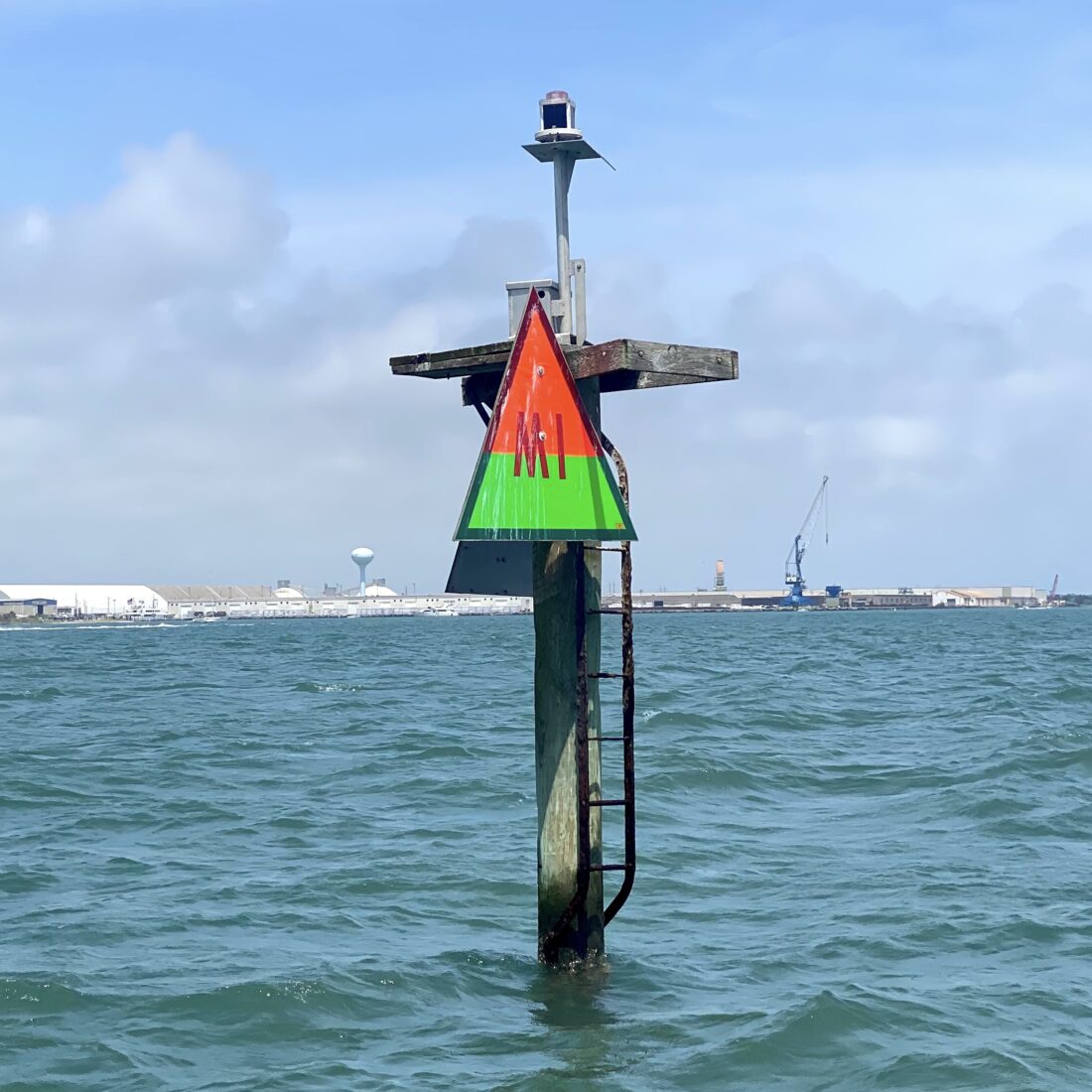
Danger Mark
These buoys will have red and black horizontal bands. They mark an isolated danger that can be passed on either side.
Preferred Channel Marker
This is a clunky name for a marker that indicates where two channels cross or diverge with either a red band over a green band or vice versa. The upper color indicates the direction of the primary, or preferred, channel. If the upper color is red, then when you are returning from open water, or moving upriver, or moving from a larger body of water to a smaller body of water (more on this below), you keep the marker to the starboard side of your boat. If the upper color is green, then when you are returning, you would pass it with the marker to the port side of your boat. If you want to take the secondary channel, then the opposite applies.
Rules of the “Road”
“Red, right, returning.”
This is the cardinal rule of inshore maritime navigation. It’s a mnemonic device to help you remember this dictum: When you are returning from sea (or moving from a larger water body to a smaller water body, or returning upriver), you keep red markers on your right.
Where’s the Water?
To determine the position of a channel in open water, you rely on three primary channel marker characteristics: Color, shape, and number. Triangular markers are red, so when returning (see above), pass these with the marker on your starboard side. Square markers correspond to the color green, so when returning, pass them on your port side. Red markers will have even numbers, and green markers will have odd numbers. The numbers should decrease as you move from smaller bodies of water toward larger bodies of water, such as exiting an inlet.
That Wacky ICW
Channel markers on the Intracoastal Waterway, which runs from Norfolk, Virginia, to Brownsville, Texas, will be marked with a separate yellow marking—a yellow triangle on red markers, and a yellow square on green markers. The ICW is considered to run clockwise, meaning it starts in Norfolk, runs south to the tip of Florida, then south to north on Florida’s Gulf Coast, then west to Brownsville. That means you are “returning” on the ICW when you’re headed “toward” Norfolk, which could mean you’re running north in Georgia but south on the Gulf Coast of Florida. It can be confusing, but imagining a map helps with this whole clockwise perspective.
If you’re temporarily confused about whether you are coming or going—and who isn’t these days?—there are a couple of other tricks to help stay off the oyster bars. In the Intracoastal Waterway, red markers will be on the landward side, and green markers on the seaward side. Still not sure? Then look for permanent ladders affixed to the posts of channel markers, especially lighted markers. The ladders are used when bulbs need changing or the markers need other maintenance and are typically mounted on the outside, or shallow side, of the channel.
Chart to Chart
And next time you’re weathered in, take a look at US Chart No. 1, produced by the National Oceanic and Atmospheric Administration. It’s not a chart at all, but a detailed, hundred-plus-page explanation of all those symbols and notations on nautical charts. It’s a pretty cool document, and I promise you will learn at least ten new things. Most of which can save both your prop and your pride.
T. Edward Nickens is a contributing editor for Garden & Gun and cohost of The Wild South podcast. He’s also an editor at large for Field & Stream and a contributing editor for Ducks Unlimited. He splits time between Raleigh and Morehead City, North Carolina, with one wife, two dogs, a part-time cat, eleven fly rods, three canoes, two powerboats, and an indeterminate number of duck and goose decoys. Follow @enickens on Instagram.