![Swan Lake at Surfside Beach
Sauceda took this photo on the first leg of his journey, up the state’s Gulf of Mexico coastline. Texas Monthly first commissioned this project, but its origins can also be traced to a bit of Texas-style bravado. “I was spending a bunch of time in the plane with my instructor, and [at the time] there was a woman named after Amelia Earhart who was intending to fly the same route that Amelia had tried to fly until she disappeared,” he says. “In the aviation world, it was a big deal. I jokingly told my buddy Peter, the flight instructor, ‘Wouldn’t it be funny if I flew a plane all the way around Texas, and call that the flight around the world?’”](https://gardenandgun.com/wp-content/uploads/2019/01/txmo_1-4871-1100x1100.jpg)
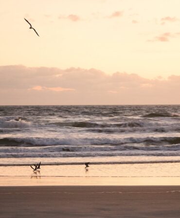
Swan Lake at Surfside Beach
Sauceda took this photo on the first leg of his journey, up the state’s Gulf of Mexico coastline. Texas Monthly first commissioned this project, but its origins can also be traced to a bit of Texas-style bravado. “I was spending a bunch of time in the plane with my instructor, and [at the time] there was a woman named after Amelia Earhart who was intending to fly the same route that Amelia had tried to fly until she disappeared,” he says. “In the aviation world, it was a big deal. I jokingly told my buddy Peter, the flight instructor, ‘Wouldn’t it be funny if I flew a plane all the way around Texas, and call that the flight around the world?’”
Photo: Jay B. Sauceda

Galveston Bay
Galveston Bay connects the Gulf with greater Houston, including La Porte, Sauceda’s hometown and a location that fed his love of flying. “I grew up really close to a small general aviation airport,” he says. “There was a small Air National Guard wing that was close by that flew fighter jets over our house, and we lived about twenty minutes away from Johnson Space Center, where the astronauts train. So aviation and aerospace mentality is very, very big in Houston. My dad was always really interested in Cold War and World War II aviation, so we spent a lot of time reading and studying that, and going to air shows where you’d see the planes fly, and getting to see this stuff up close and personal.”
Photo: Jay B. Sauceda

Sabine National Forest
Sabine National Forest lies along the Texas–Louisiana border, on the Toledo Bend Reservoir, in Hemphill.
Photo: Jay B. Sauceda
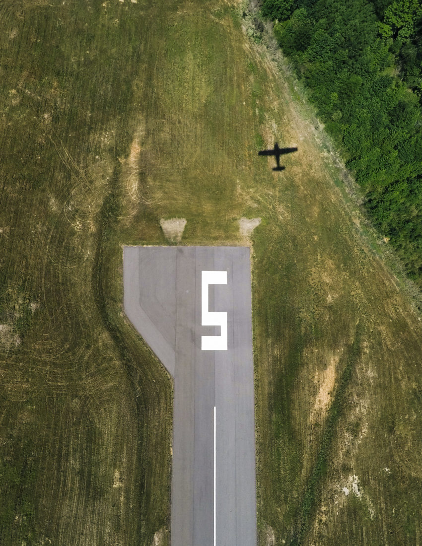
Harrison County Airport
Sauceda took this “self-portrait” of his plane at a Marshall, Texas, airport, about twenty miles west of the Louisiana border (and about 150 miles east of Dallas). Depending on how quickly he could snag one of his cameras, and what kind of photo he wanted to take, Sauceda used a small Fujifilm rangefinder, a medium-format digital camera, or let the two GoPro cameras attached to the wings do the work. “Between having autopilot, and the fact that really, you’re up there just kind of maintaining, there’s more free time to grab a camera and stick it out the window than you would think,” he says.
Photo: Jay B. Sauceda

South of the Canadian River
Sauceda took this self-portrait on the third leg of his flight, as he traveled between Texline and El Paso. “There are parts of the state you can only really appreciate from the air because it’s on private land,” says Sauceda. “To me it’s a massive bummer that you can’t see some of these beautiful areas. On the flipside, one of the things that has developed is that there’s also this mystique around some of these isolated and controlled areas. Some of these massive, tens-of-thousands-of-acre ranches have this mystique to them because it’s been in a family for so long and only a certainly number of people have been there.”
Photo: Jay B. Sauceda

Farmland outside of Littlefield
Sauceda side-tracked to Littlefield, he writes in his book, to pay homage to the birthplace of Waylon Jennings.
Photo: Jay B. Sauceda

Farmland near Littlefield
Another self-portrait, this time about fifty miles northwest of Lubbock.
Photo: Jay B. Sauceda
Guadalupe Peak, Guadalupe Mountains National Park
A shot of the highest natural point in Texas, just south of the New Mexico border.
Photo: Jay B. Sauceda

Jane A. Hambric School, El Paso
The Upper Vista Real neighborhood of El Paso, in the far western tip of Texas.
Photo: Jay B. Sauceda

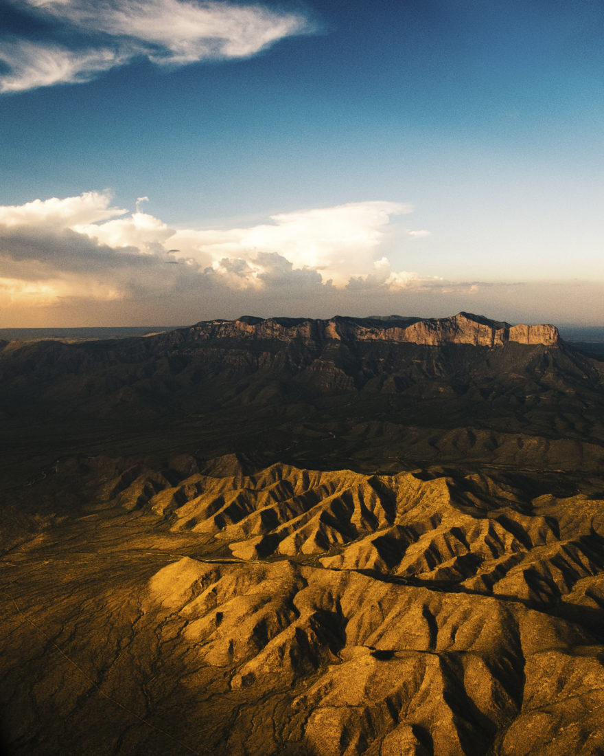
Chisos Mountains, Big Bend National Park
The Chisos are the only mountain range in the country to be contained within a national park; Big Bend is comprised of more than 800,000 acres along the Texas–Mexico border. Sauceda’s heart straddles both places. “We’re what are known as Tejanos,” he says of his family. “Our roots really predate Texas as a country or a state. We’re Mexican, but our family was traced back to having been here in Texas before it became Texas.”
Photo: Jay B. Sauceda

South Padre Island
Vacationers flock to this skinny shoreline, a resort area just north of where the Rio Grande flows into the Gulf of Mexico, on the Texas–Mexico border.
Photo: Jay B. Sauceda
![Padre Island
On the final day of the final leg of his trip, Sauceda flew over the sand dunes of Padre Island, south of Corpus Christi. “Over time, the thing I seek out to show people [from this project] is by far the abstract,” he says. “Instead of showing an image of the mountains from the side, it’s more about showing an image of the foot of the mountains, overhead, and it looks like when you look down at the back of your hand and you see all the crinkles in your skin—seeing the landscape that way is actually more interesting.”](https://gardenandgun.com/wp-content/uploads/2019/01/txmo_7-42399-Edit-1100x821.jpg)
Padre Island
On the final day of the final leg of his trip, Sauceda flew over the sand dunes of Padre Island, south of Corpus Christi. “Over time, the thing I seek out to show people [from this project] is by far the abstract,” he says. “Instead of showing an image of the mountains from the side, it’s more about showing an image of the foot of the mountains, overhead, and it looks like when you look down at the back of your hand and you see all the crinkles in your skin—seeing the landscape that way is actually more interesting.”
Photo: Jay B. Sauceda